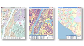
Satellite Maps
- Clear Satellite Imagery.
- All formats, Printed, Digital,
Wall, Report, & Book.
- Free Shipping. Fast Delivery.

Wall Maps
2x3 to 9x12 feet,
Laminated, Mounted and more
Gain the Advantage of a Satellite View
Our clients use satellite maps for many different things in a variety of industries. Our clear satellite imagery allows
us to create quality satellite maps of anywhere in the world - from nationwide to neighborhood.
The Details & Data You Need
-
Overlay roads, highways, geographic boundaries and labels
for counties, cities and ZIP Codes or even your own
territories or market areas
-
Plot business locations using their logos
-
Add radius rings and drive time polygons
-
Display traffic counts, business counts, demographics,
sales data and more
Satellite Map Solutions
for Your Business
- View existing, and plan for future, developments
and shopping centers
- Get an overview of land use including farms
- Scout neighborhoods for target customers for roofing
- Tracking operations in the oil and gas industry
- Plan out future subway transit or roadways
Need a State or County Satellite Map?
Order Your Maps Online!
Talk to us about Satellite Maps Today!
Available as FAST as SAME DAY!
Talk to a Map Specialist:
1-888-434-6277
 On Target. On Time.
The maps you need,
when you need them
 Maps of Everywhere
From World to National to Local